UPDATE: San Antonio area to see higher risk of severe storms Friday
UPDATE 12:35 p.m.:
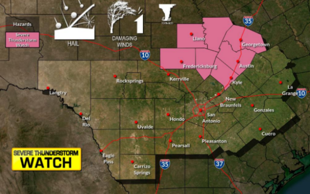
The National Weather Service is predicting the chance for severe weather may be further west than previously forecast.
The enhanced risk of severe storms now reaches Burnet and San Marcos. The slight risk now includes all of Bexar County, with the line moving west from the U.S. 281 corridor to the Fredericksburg and Castroville areas.
Areas like Uvalde, Eagle Pass and Del Rio now have a chance of seeing some thunderstorms from this weather system.

ORIGINAL:

SAN ANTONIO (KTSA News) — Things could get soggy to the north and east of San Antonio this week.
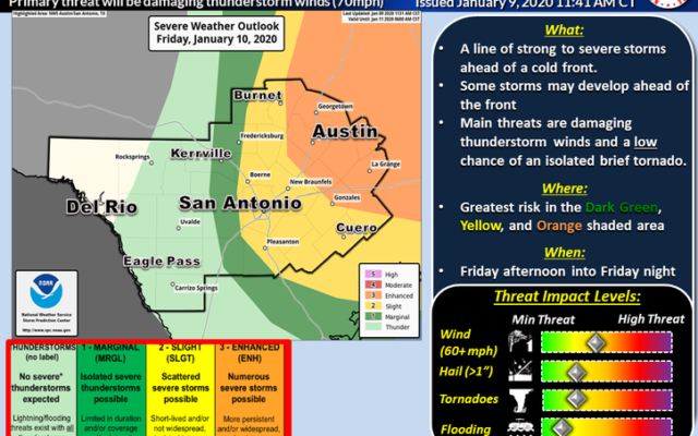
The National Weather Service is predicting strong to severe storms are possible for the region Friday afternoon into Friday night.
There’s been a lot of humidity on the air recently which will combine with a cold front that going to move through the area Friday afternoon.
That will likely trigger a line of showers and thunderstorms which could contain damaging winds, large hail and maybe even an isolated tornado.
The Storm Prediction Center has placed areas east of Highway 281 under a marginal risk of severe storms with locations east of Florence to Austin to Luling to Speaks line under Enhanced Risk for Severe Weather.
The possibility of strong storms could develop in the area of Interstate 35 as well.
These storms should be out of the region by Saturday morning with a few light showers possible early with plenty of sunshine but cooler with a high of 63.
You Might Also Like