Potential severe weather coming for Hill Country, San Antonio and Austin Wednesday
SAN ANTONIO (KTSA News) — Severe weather is expected to move through the San Antonio and Austin regions overnight Tuesday into Wednesday morning.

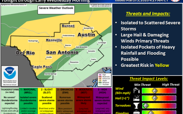
The National Weather Service said a potent upper level storm system and cold front will bring a good chance for rain and storms to the region with some of those storms potentially becoming severe.
The higher risk for severe weather will be north and west of San Antonio and north of New Braunfels.
The system will move through the Rio Grande area between 8 p.m. and 2 a.m., the Hill Country from midnight to 6 a.m. and the San Antonio and Austin areas between 5 and 9 a.m.
The storm could bring 1.5 to 2 inches of rain to some areas, bringing the potential for isolated pockets of flooding. The higher rainfall totals are expected in areas like Kerrville and Burnet.
San Antonio could see less than a half inch of rain. Austin could see one to one-and-a-half inches of rain.

You Might Also Like