Severe storm chance with potential flash flooding for greater San Antonio area

SAN ANTONIO (KTSA News) — Another round of potentially severe weather will be making its way to the greater San Antonio area starting Monday night.
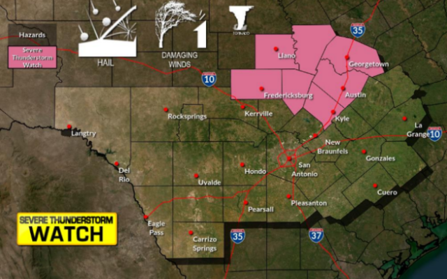
The National Weather Service in New Braunfels said there is a chance for severe storms across the entire region, the greater chance for these storms will be further west — including areas like Del Rio and Rocksprings. There is a slight risk for severe weather for the northwestern corner of Bexar County and points north and west.

Forecasters said the primary threat for Monday’s storms will be large hail and damaging wind gusts, though heavy downpours are expected through Wednesday. The heavy downpours can bring flash flooding.
The San Antonio region itself could see about five inches of rain through Thursday, though areas to the northeast like New Braunfels could see up to eight inches and the Austin area could see up to 10 inches of rain.
These storms could produce hail of up to an inch in diameter as far east at the Interstate 35 corridor. The Uvalde and Eagle Pass area could see hail larger than two inches in diameter.
Few isolated tornadoes are possible, though primarily over the Rio Grande Plains.
You Might Also Like