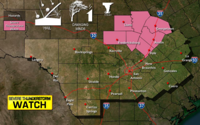
Severe storms possible in Hill Country this week

SAN ANTONIO (KTSA News) — Severe weather could make a visit to the Hill Country and San Antonio area Tuesday night and Wednesday.
The greatest chance of seeing these storms are west of San Antonio.
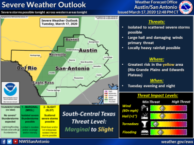

The National Weather Service said two rounds of storms are possible Tuesday night and Wednesday afternoon/evening. The first set of storms will primarily affect an area west of a line from Carrizo Springs to Boerne to Burnet.
Wednesday’s storms are expected to affect a larger area — primarily along and west of Interstate 35.
The main threat from these storms will be hail and damaging winds, though an isolated tornado cannot be ruled out — especially from Wednesday’s storms in the Edwards Plateau. That same area could see some locally heavy rainfall Tuesday night.
You Might Also Like