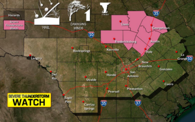
Wind gusts up to 70 mph, tornado and hail possible in San Antonio area
SAN ANTONIO (KTSA News) — A line of thunderstorms moving across Texas is expected to bring dangerous conditions to many parts of the state late Friday afternoon and early evening, including the San Antonio metro area.
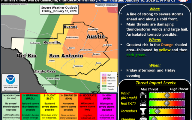
The National Weather Service says an upper-level storm system and cold front will form a line of thunderstorms that will move through the region during the evening hours.
Forecasters anticipate the largest threat will be damaging straight-line winds and large hail, though an isolated tornado is possible.
An area east of a line from Rocksprings to Carrizo Springs will be at risk for severe weather, with the largest risk in the region being east of a line from Llano, New Braunfels and Halletsville.

The storms can bring winds up to 70 miles per hour, hail up to two inches in diameter and anywhere from 1/4 of an inch to 3/4 of an inch of rain, though some areas could see one or two inches of rain.
The line of storms is expected to move out Friday night, though there may be some lingering showers Saturday morning.
You Might Also Like