Winter Weather Warning issued for parts of the Hill Country
SAN ANTONIO (KTSA News) — Another shot of winter is coming to the region.
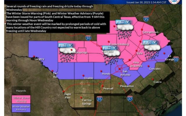
According to the National Weather Service, two rounds of freezing rain and drizzle could fall over portions of the Hill Country and the IH-35 corridor beginning Monday morning and stretching into early Wednesday afternoon.
Light freezing drizzle is possible over the Hill Country and I-35 corridor today with a second round of potentially heavier freezing rain Tuesday morning and afternoon.
Forecasters are saying the greatest potential for freezing precipitation will be over the Hill Country, where temperatures are expected to be below freezing for nearly 48 hours.
NWS has put out a Winter Storm Warning for Bastrop, Caldwell, Comal, Hays and Lee Counties starting at 9 A.M Monday and lasting through Wednesday at Noon.
Ice accumulations of up to a quarter of an inch are possible in the warning areas.
Travis and Williamson Counties could see some freezing precipitation as well.
Be advised that travel on the area could be hazardous in the region and your commute could be impacted.

You Might Also Like