Lee becomes hurricane, forecast to be “extremely dangerous” storm
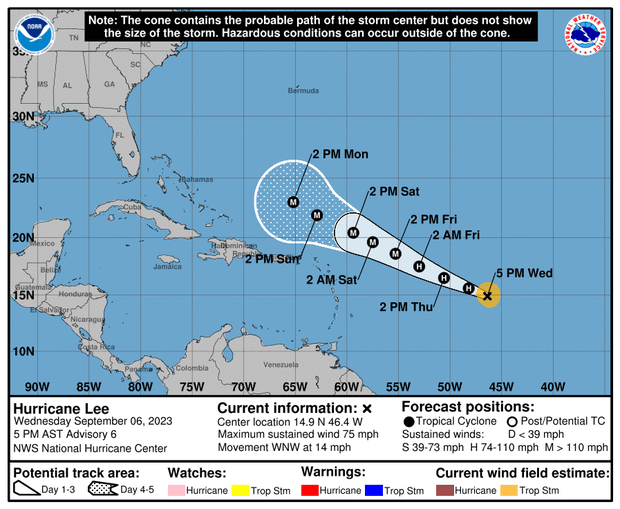
“Swells are likely to cause life-threatening surf and rip currents across portions of the Lesser Antilles late this week,” according to the hurricane center, which said swells generated by the storm will reach portions of that area on Friday. Lee could impact the northern Leeward Islands this weekend, the center said.
As of 5 p.m. EDT on Wednesday, Lee was still traveling west-northwest at 14 mph over the southern Atlantic Ocean, with maximum sustained winds of 75 mph. Its center was about 1,130 miles east of the northern Leewards.
Earlier Wednesday. Lee’s center was some 1,265 miles east-southeast of the northern Leewards moving west-northwest at 14 mph and packing maximum sustained winds of 65 mph — a pickup of 15 mph in mere hours.
This comes just days after Hurricane Idalia left a path of destruction across the Southeast.
That storm made landfall Wednesday in Florida, where it razed homes and downed power poles. It then headed northeast, slamming Georgia, flooding many of South Carolina’s beachfronts and sending seawater into the streets of downtown Charleston. In North Carolina, it poured more than 9 inches of rain on Whiteville, flooding downtown buildings.
Idalia claimed at least two lives, one in Florida and the other in Georgia.
Idalia’s impact from damage and lost economic activity is expected to be in the $12 to $20 billion range, according to Moody’s Analytics.
You Might Also Like