National Weather Service: Strong To Severe Thunderstorms Remain Possible Thursday Afternoon And Night; Gusty Winds Through Friday Morning
SAN ANTONIO (KTSA News) — The National Weather Service continues to offer updates on some strong storms that may impact the San Antonio area this week.
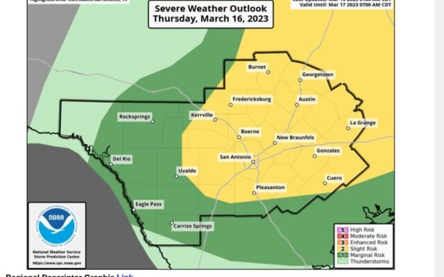
As of 4 A.M., the latest information shows two separate rounds of showers are possible from Thursday afternoon through early Friday morning.
Initially, the threat will be in the form of isolated storms bringing large hail to the area East of IH-35 Thursday afternoon.
Then a second round of storms is expected late Thursday bringing heavy wind, rain possible tornadoes with much cooler temperatures to follow.
Some of the winds could range form 40 to 50 miles per hour as the tail end of the system blows through the region early Friday morning.
The greatest severe potential remains over Hill Country, the I-35 Corridor, and the Coastal Plains. Isolated severe storms can’t be ruled out in the Southern Edwards Plateau and Rio Grande Plains.
NWS will issue an update on the weather situation by 2 P.M. Wednesday.
You Might Also Like